This page supports a nineteen-chapter timeline that treats Indigenous continuity, Latino and immigrant lives, Californio experience, architecture, and civic development as parts of the same local history. Six chapters center Indigenous history, three follow immigrant experiences, two make Latino and Mexican American memory visible, seven follow land, town, and civic change, and one closes with living culture and memory. The chapter counts organize the display; they do not make these experiences equivalent or complete.
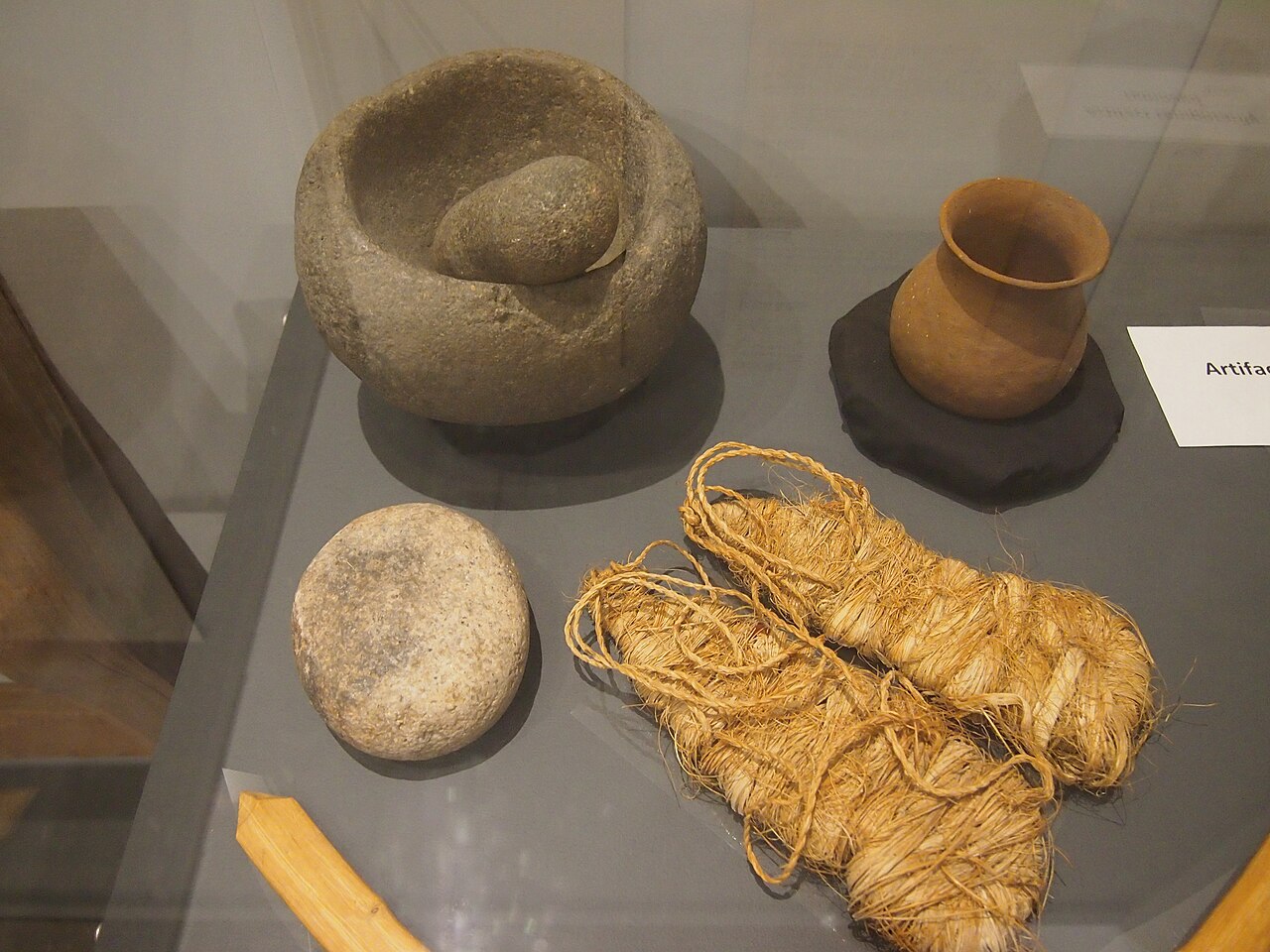
A museum display described by the photographer as part of a San Diego history collection includes a stone mortar and pestle and other Kumeyaay material culture. It is museum context, not a dated Escondido archaeological find.Credit: SlowkingImage credit and rights
Credit
Photo by Slowking, CC BY-NC 3.0, via Wikimedia Commons. Local copy uses Wikimedia's 1280px resized file; no Escondidopedia edits.
Noncommercial reuse only under CC BY-NC 3.0; retain attribution and license link. Do not present the display as a dated Escondido excavation or disclose archaeological-site provenance.
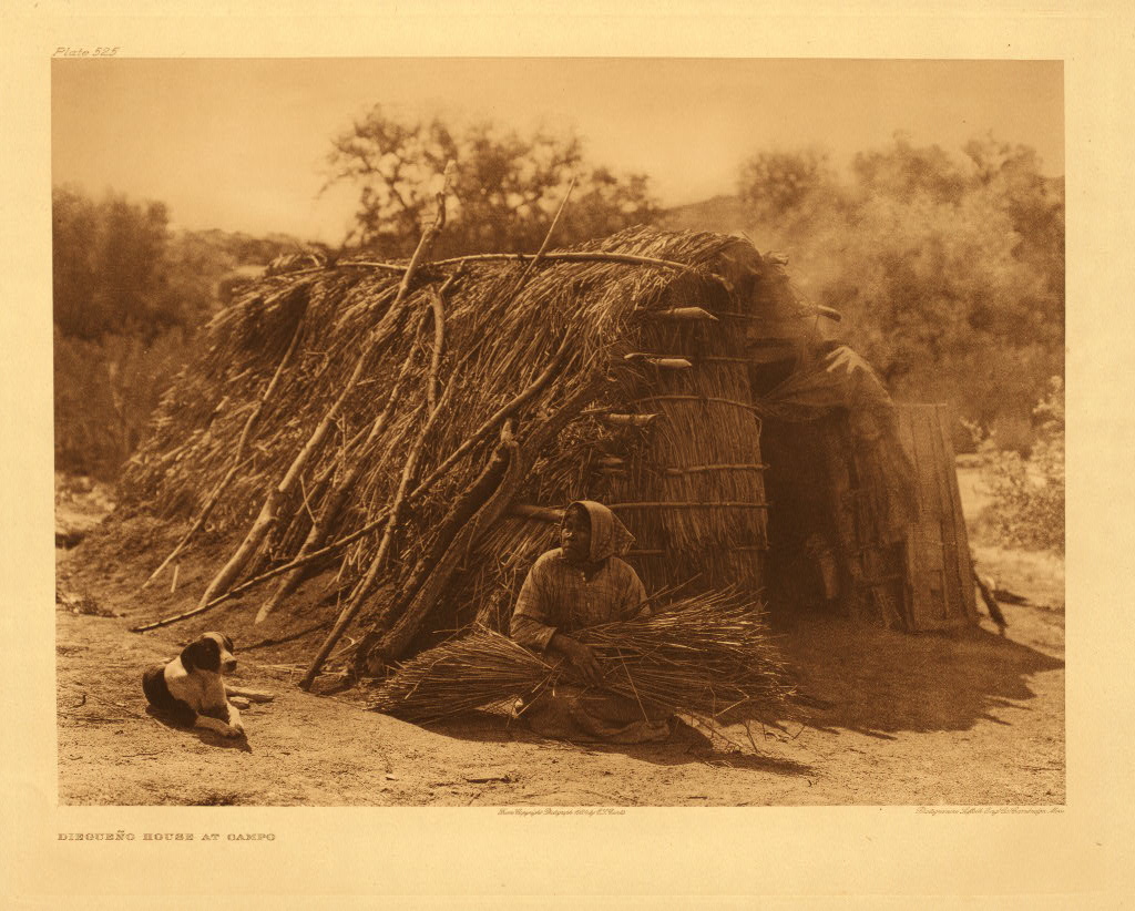
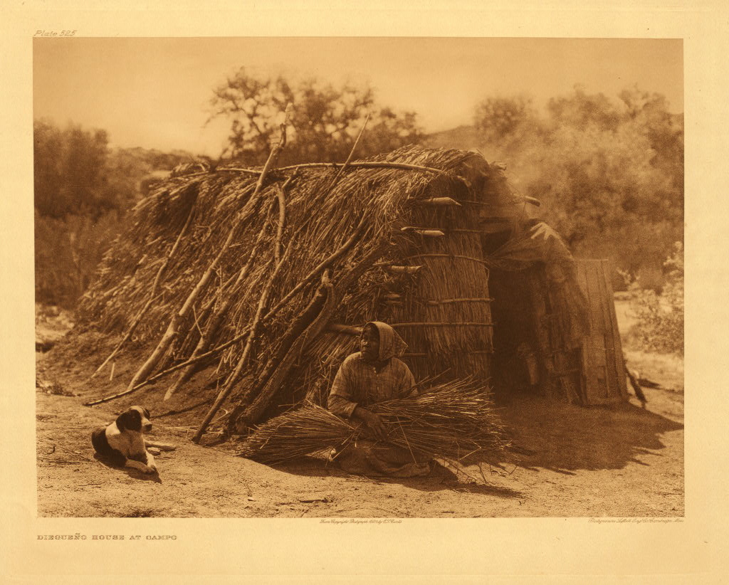
Edward S. Curtis photographed an unnamed Kumeyaay woman at Campo in an image published in 1926. The photograph is later than this chapter’s pre-1769 period and is not evidence of unchanged lifeways.Credit: Edward S. CurtisImage credit and rights
Credit
Edward S. Curtis, published 1926, from The North American Indian. Northwestern University Library via Wikimedia Commons; public domain in the United States.
Retain the 1926 date and ethnographic-photography context; do not present the image as pre-contact life, an Escondido scene, or an account of Luiseño people.
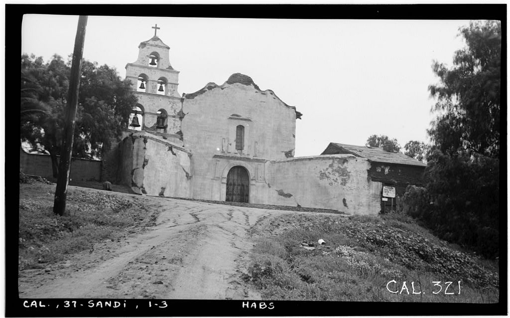
Mission San Diego de Alcalá’s south façade in a December 1936 Historic American Buildings Survey photograph.Credit: Henry F. Withey for the Historic American Buildings SurveyImage credit and rights
Credit
Henry F. Withey, Historic American Buildings Survey, December 1936. Library of Congress, HABS CAL,37-SANDI,1--3.
Creator
Henry F. Withey for the Historic American Buildings Survey
The Library of Congress reports no known restrictions on images made by the U.S. Government; retain the 1936 date and do not present the photograph as a mission-period scene.
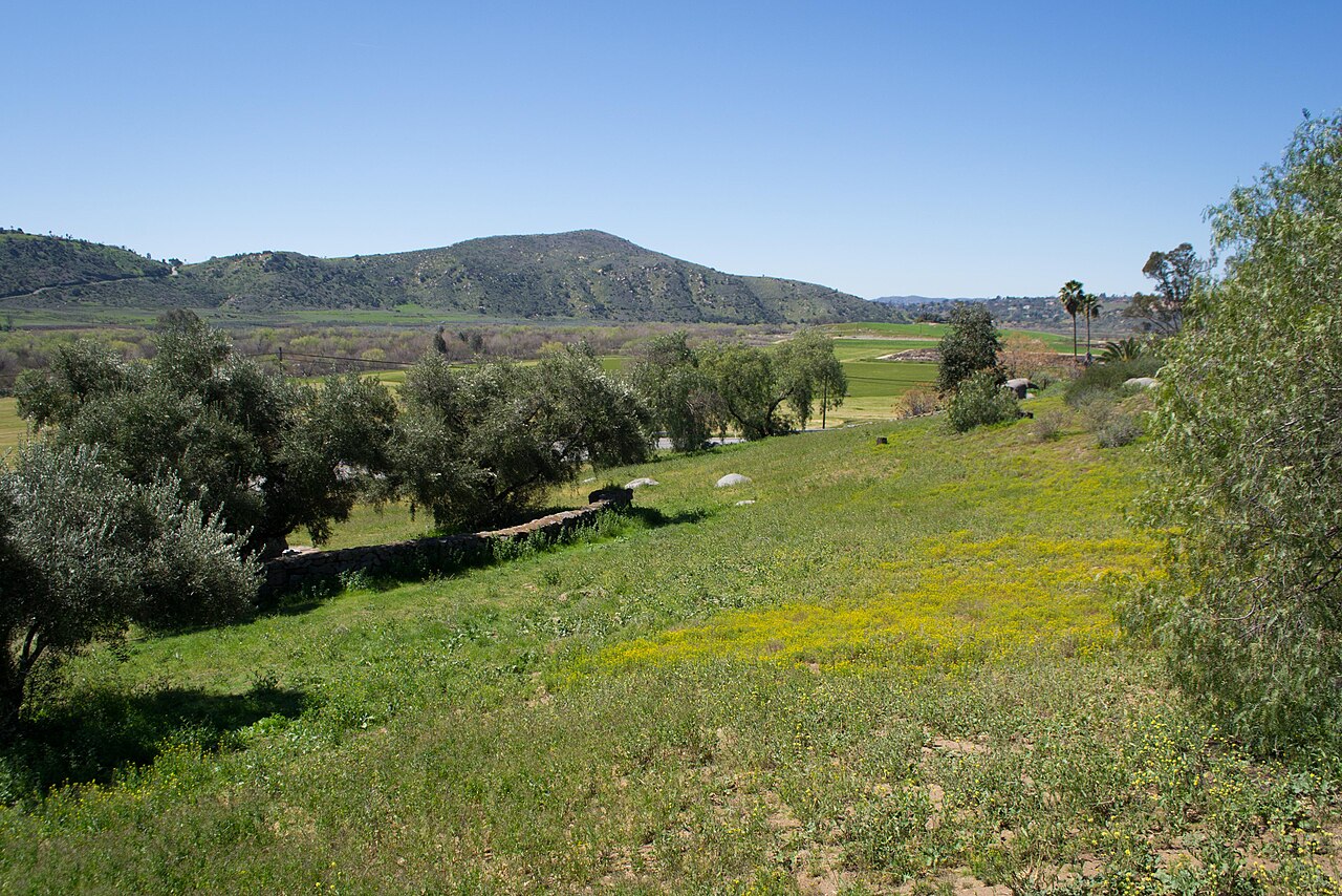
San Pasqual Valley in 2013. The view establishes the place named in the San Pasqual Band’s history; it does not locate or reconstruct the 1835 Pueblo.Credit: Visitor7Image credit and rights
Credit
Photo by Visitor7, CC BY-SA 3.0, via Wikimedia Commons. Local copy uses Wikimedia's 1280px resized file; no Escondidopedia edits.
Reuse under CC BY-SA 3.0 with attribution and share-alike terms; do not infer the Pueblo’s precise location from this modern view.
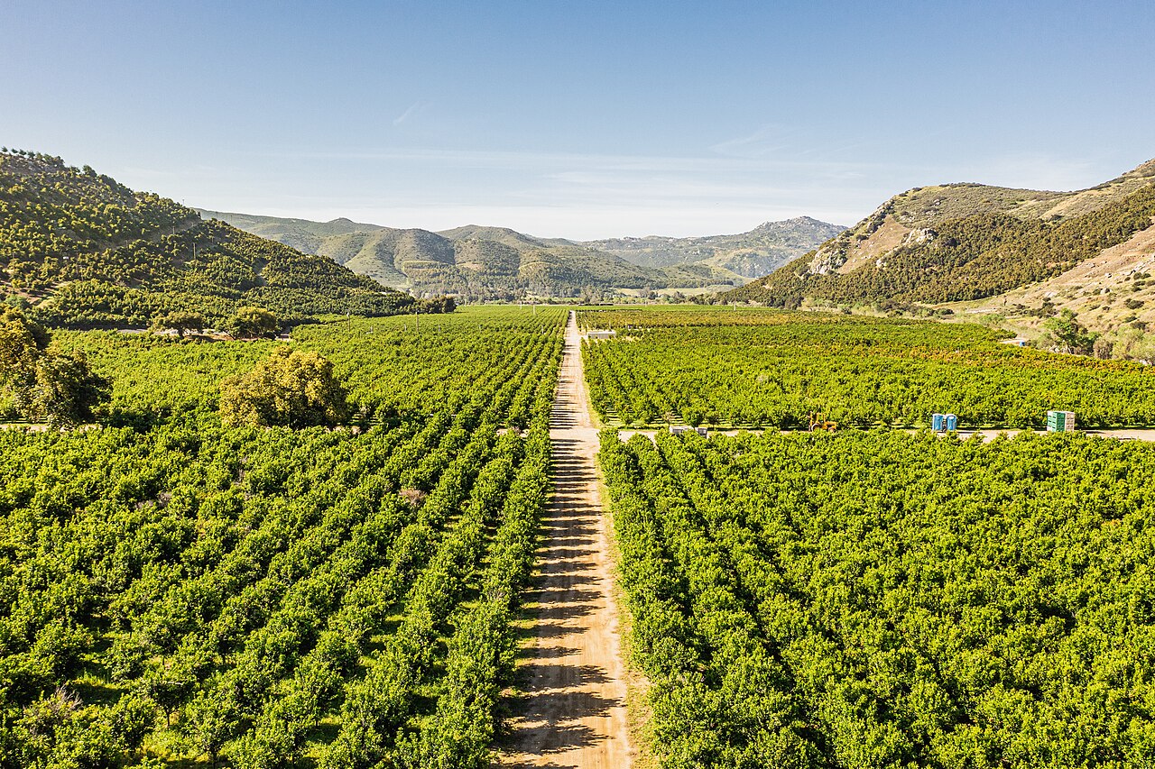
A modern citrus orchard in San Pasqual Valley. It illustrates the valley’s agricultural landscape, not Panto’s nineteenth-century village or its crops.Credit: Mark SkovorodkoImage credit and rights
Credit
Photo by Mark Skovorodko, CC BY-SA 4.0, via Wikimedia Commons. Local copy uses Wikimedia's 1280px resized file; no Escondidopedia edits.
Reuse under CC BY-SA 4.0 with attribution, license link, share-alike for adaptations, and change indication if modified.
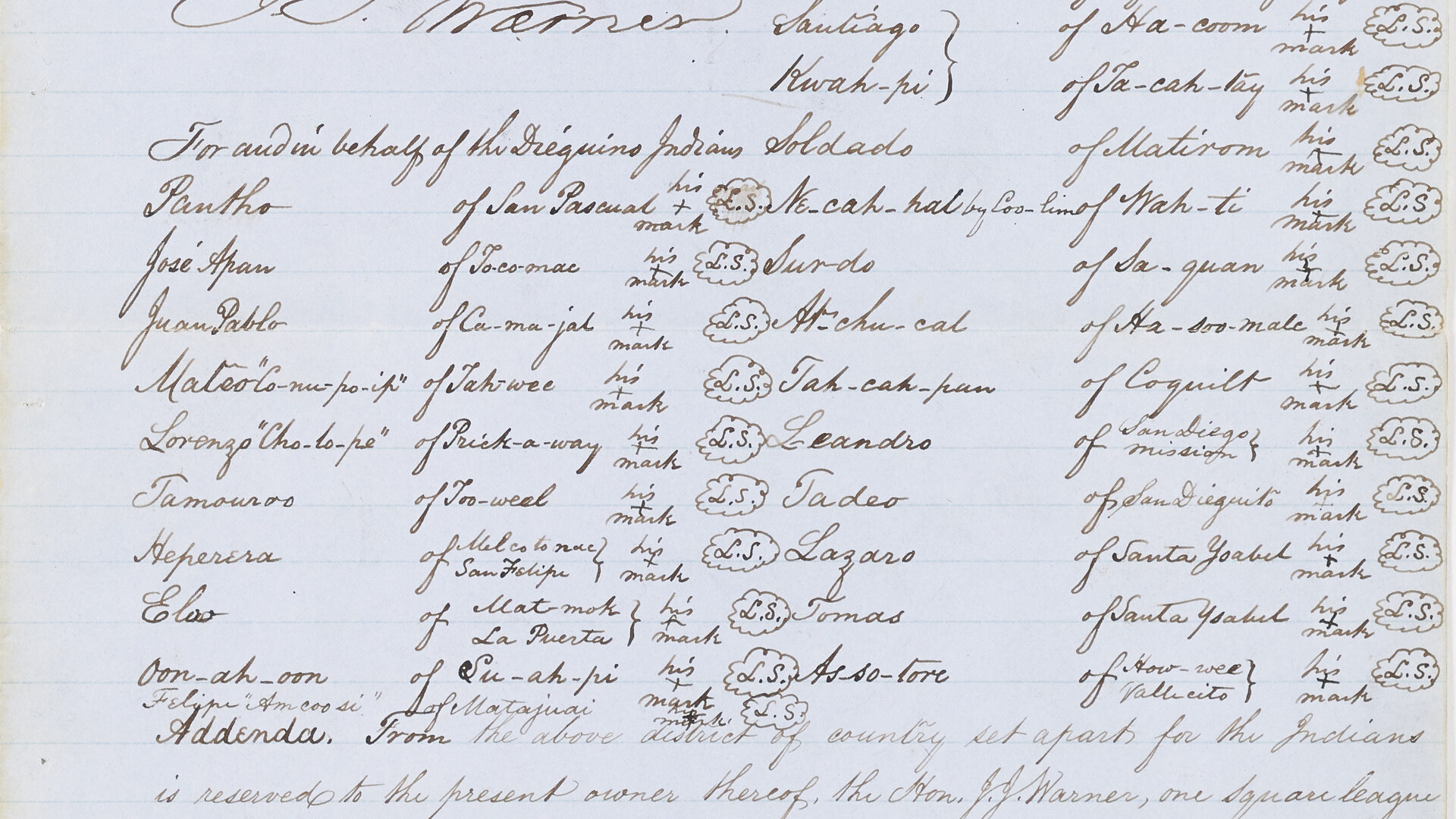
The original handwritten 1852 Treaty of Santa Ysabel records ‘Pantho of San Pascual’ with a cross as his mark.Credit: United States Office of Indian AffairsImage credit and rights
Credit
National Archives and Records Administration, Records of the Bureau of Indian Affairs, Record Group 75, Unratified Treaty File, Treaty L, NAID 245237956, image 5.
The National Archives catalog marks access and use unrestricted. Retain the unratified-treaty context; the local image is a crop of image 5, with no text altered.
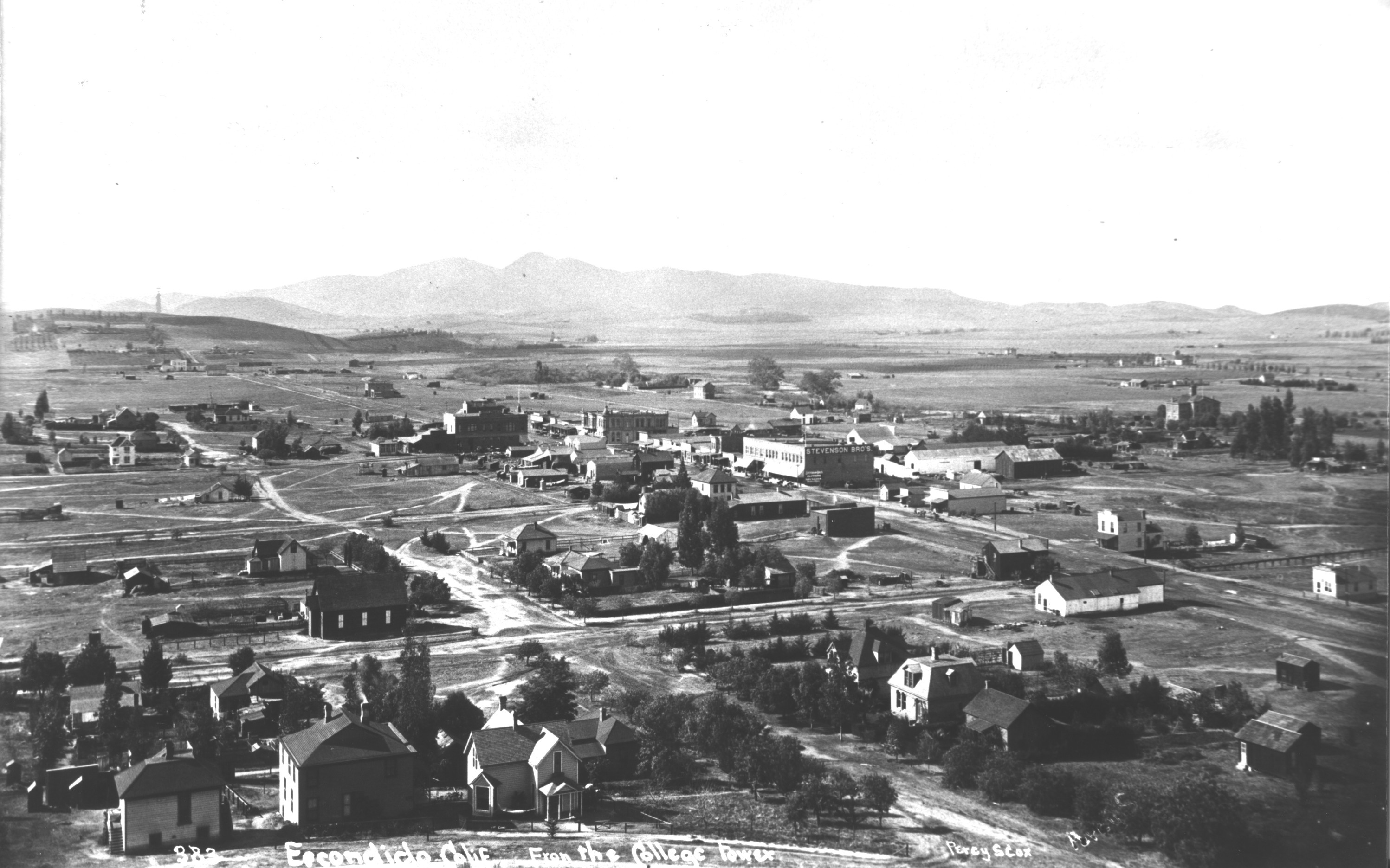
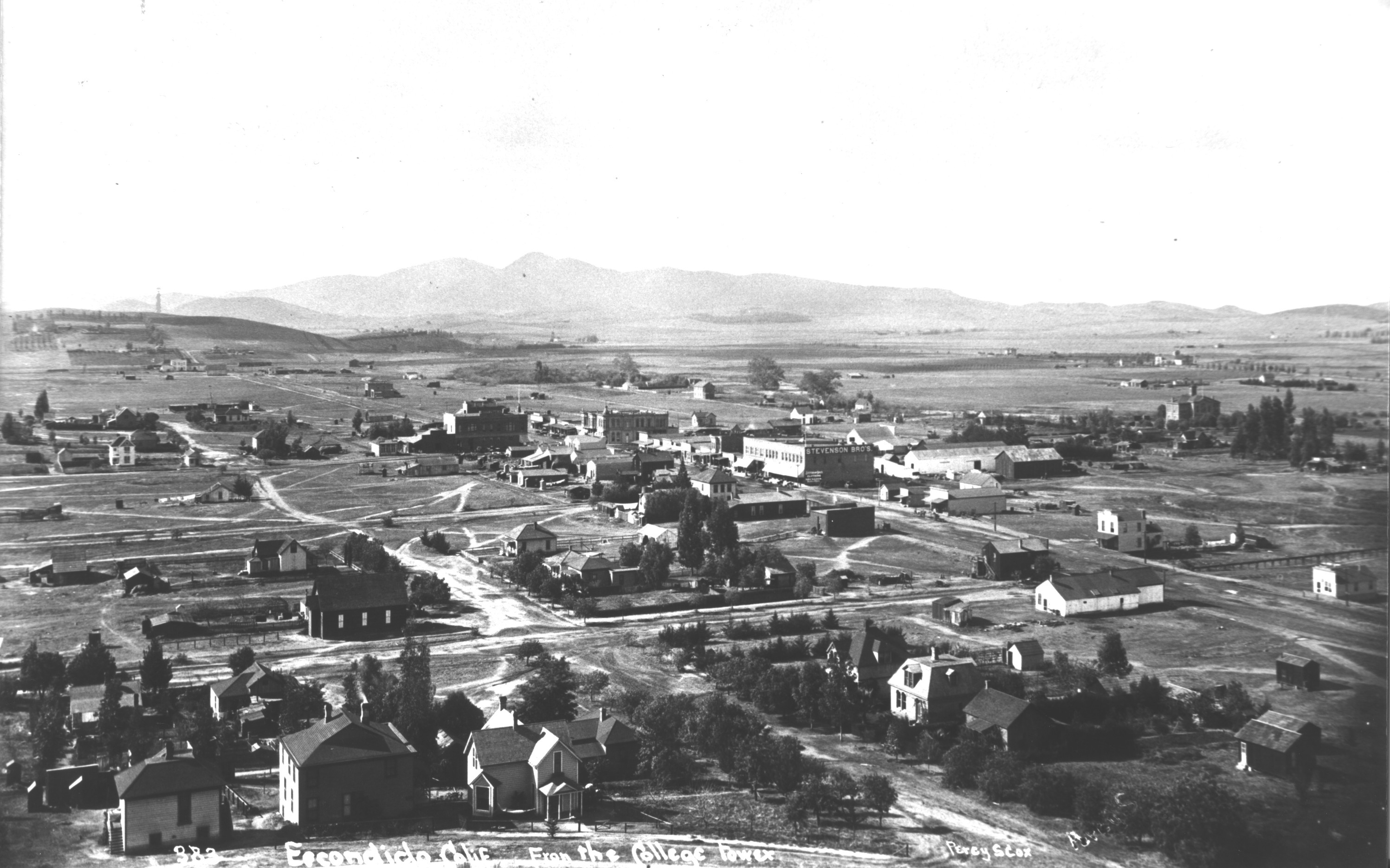
An elevated historical view of Escondido. The source page does not provide a date or caption beyond the file name.Credit: Photographer not identified on source pageImage credit and rights
Credit
Escondido History Center, file 688; photographer not identified on source page.
Displayed only on Escondidopedia’s History of Escondido page and timeline with source attribution and link-back; remove on a substantiated publisher or rights-holder request.
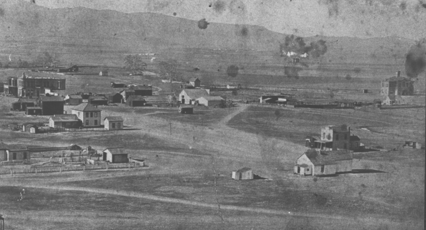
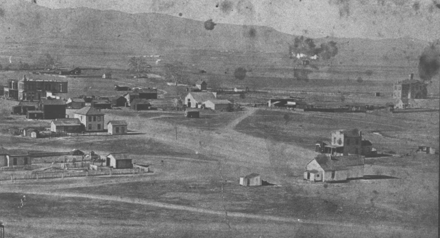
An elevated historical view of homes and open lots in Escondido. The source page provides catalog #165 but no date.Credit: Photographer not identified on source pageImage credit and rights
Credit
Escondido History Center, catalog #165; photographer not identified on source page.
Displayed only on Escondidopedia’s History of Escondido page and timeline with source attribution and link-back; remove on a substantiated publisher or rights-holder request.
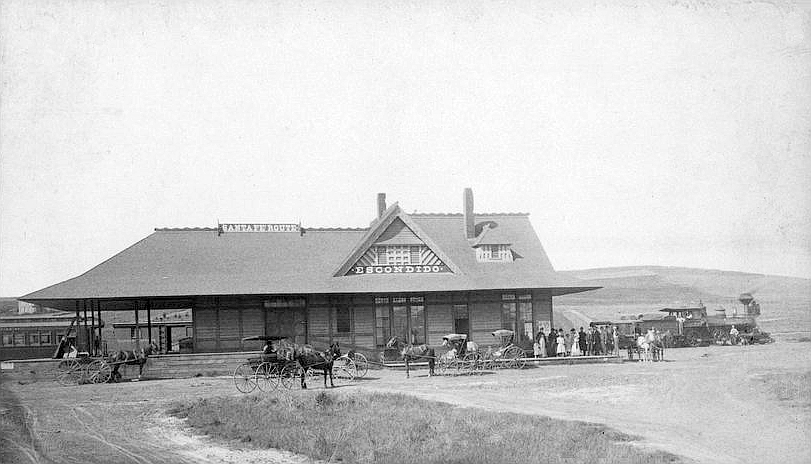
The Atchison, Topeka and Santa Fe Railway depot in Escondido, photographed circa 1887–1889.Credit: J. E. SlocumImage credit and rights
Credit
J. E. Slocum, circa 1887–1889. Kansas Memory, via Wikimedia Commons.
Public domain in the United States. Retain the approximate date and source; do not infer the identities of people shown or undocumented station operations.
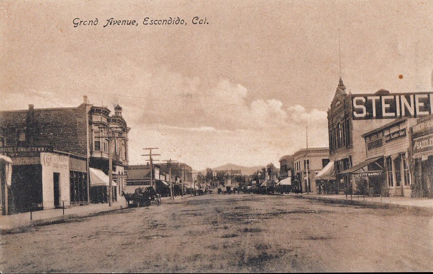
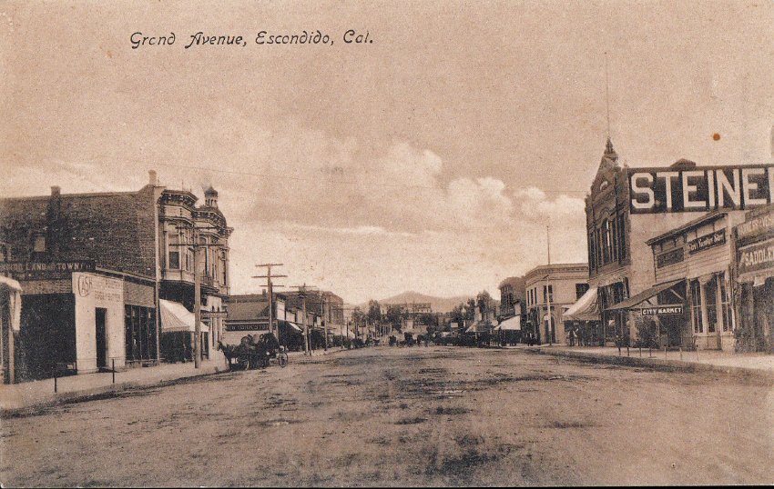
A historical postcard view labeled “Grand Avenue, Escondido, Cal.” The source page provides catalog #336 but no date.Credit: Photographer not identified on source pageImage credit and rights
Credit
Escondido History Center, catalog #336; photographer not identified on source page.
Displayed only on Escondidopedia’s History of Escondido page and timeline with source attribution and link-back; remove on a substantiated publisher or rights-holder request.
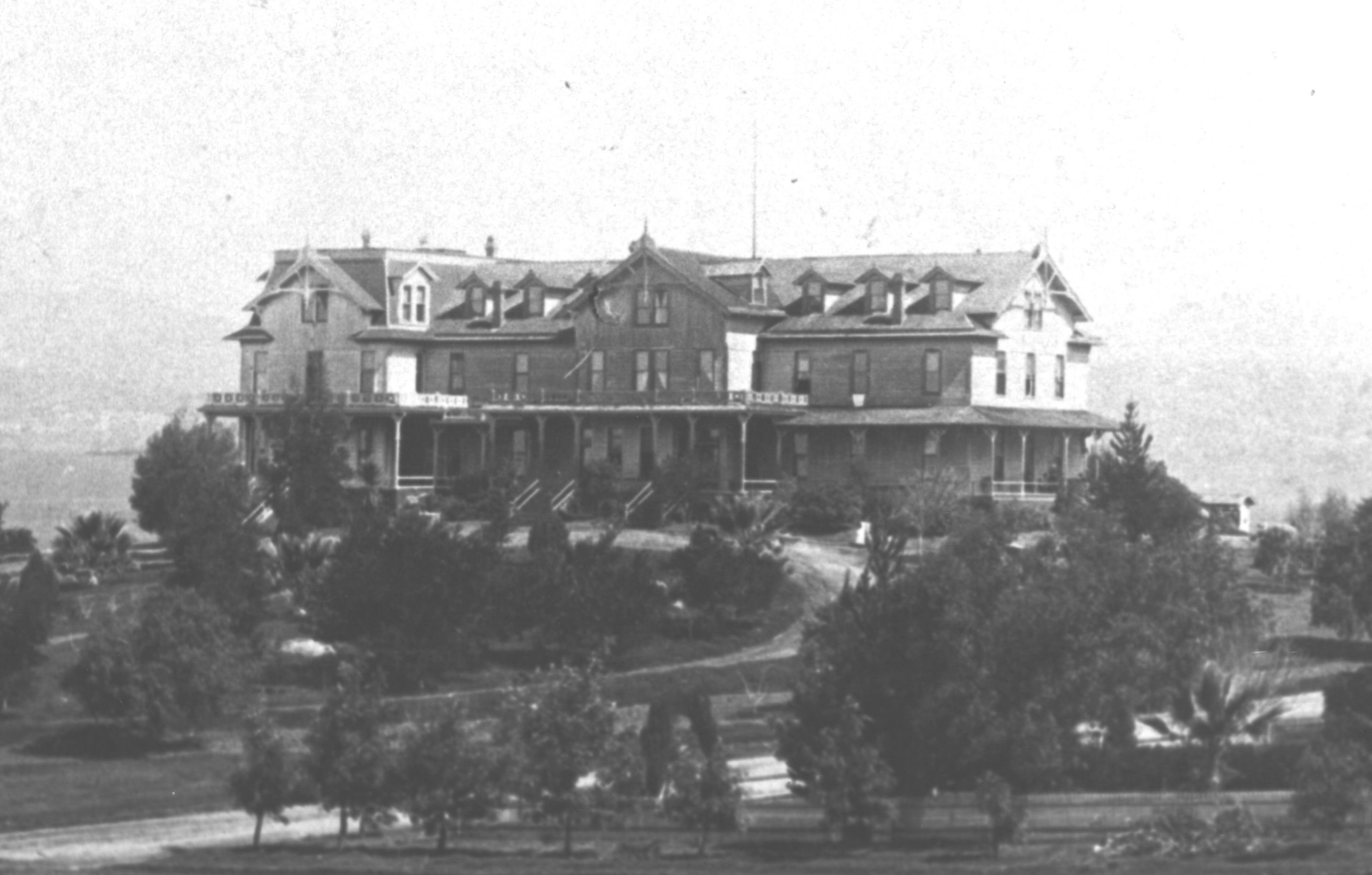
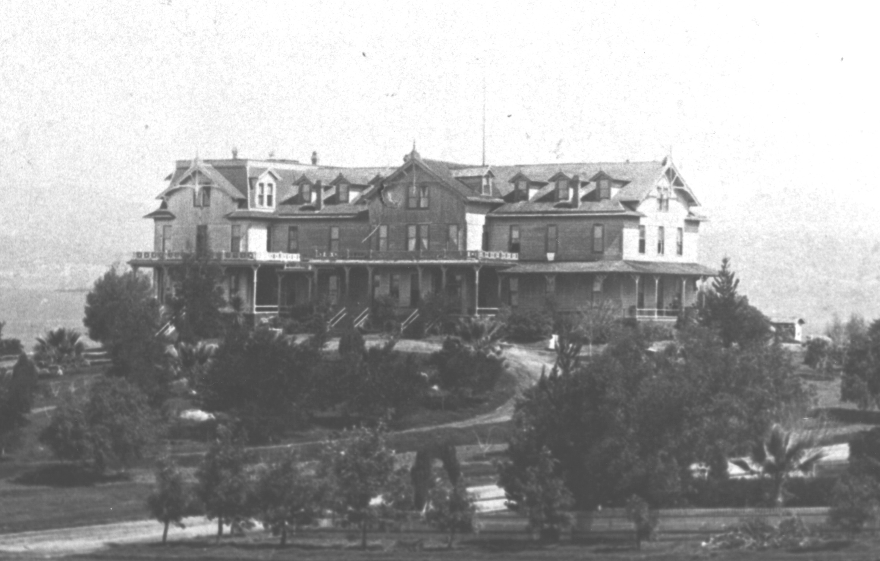
A view of Hotel Escondido, built by the Escondido Land and Town Company. The source page does not provide a date.Credit: Photographer not identified on source pageImage credit and rights
Credit
Escondido History Center, catalog #46; photographer not identified on source page.
Displayed only on Escondidopedia’s History of Escondido page and timeline with source attribution and link-back; remove on a substantiated publisher or rights-holder request.
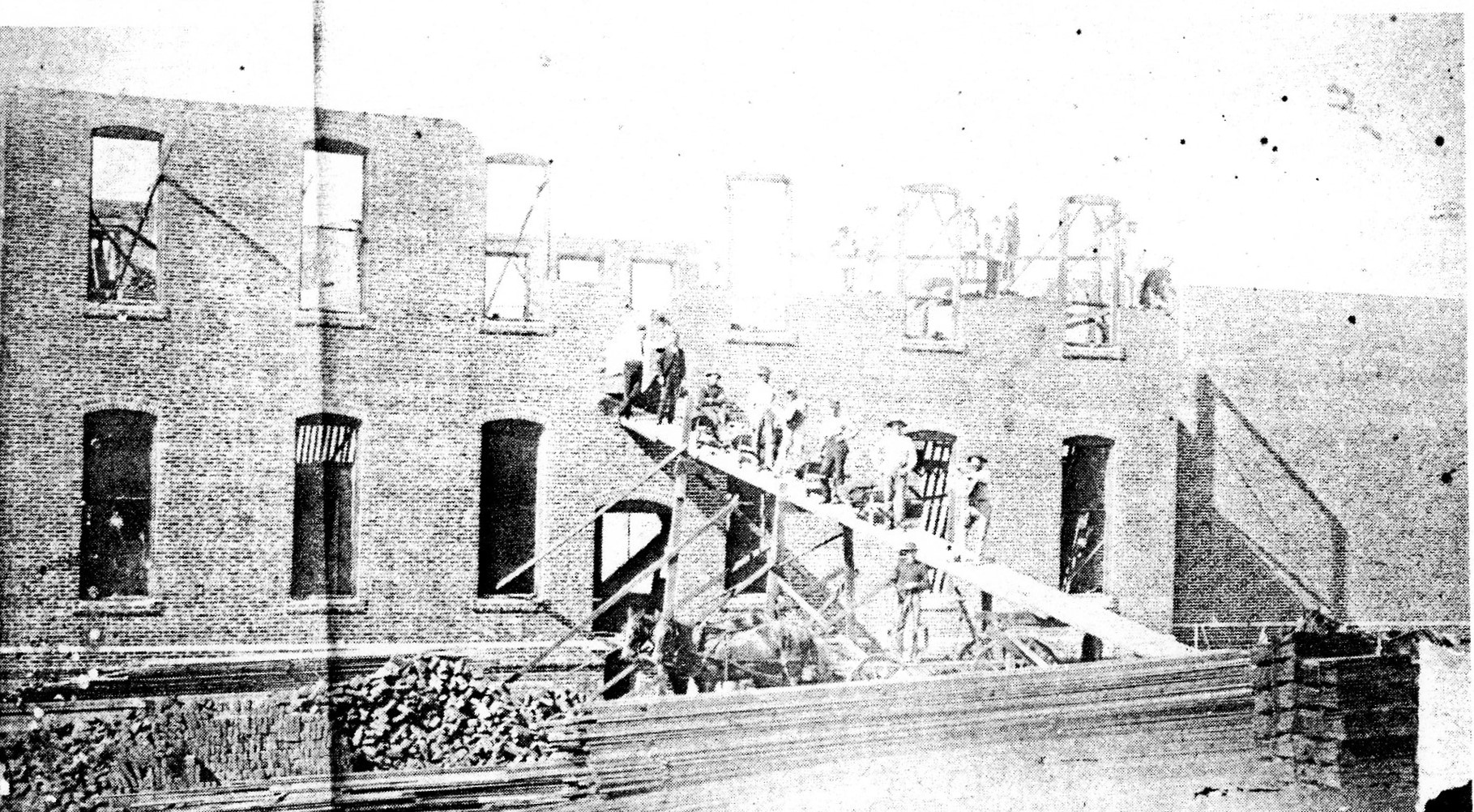
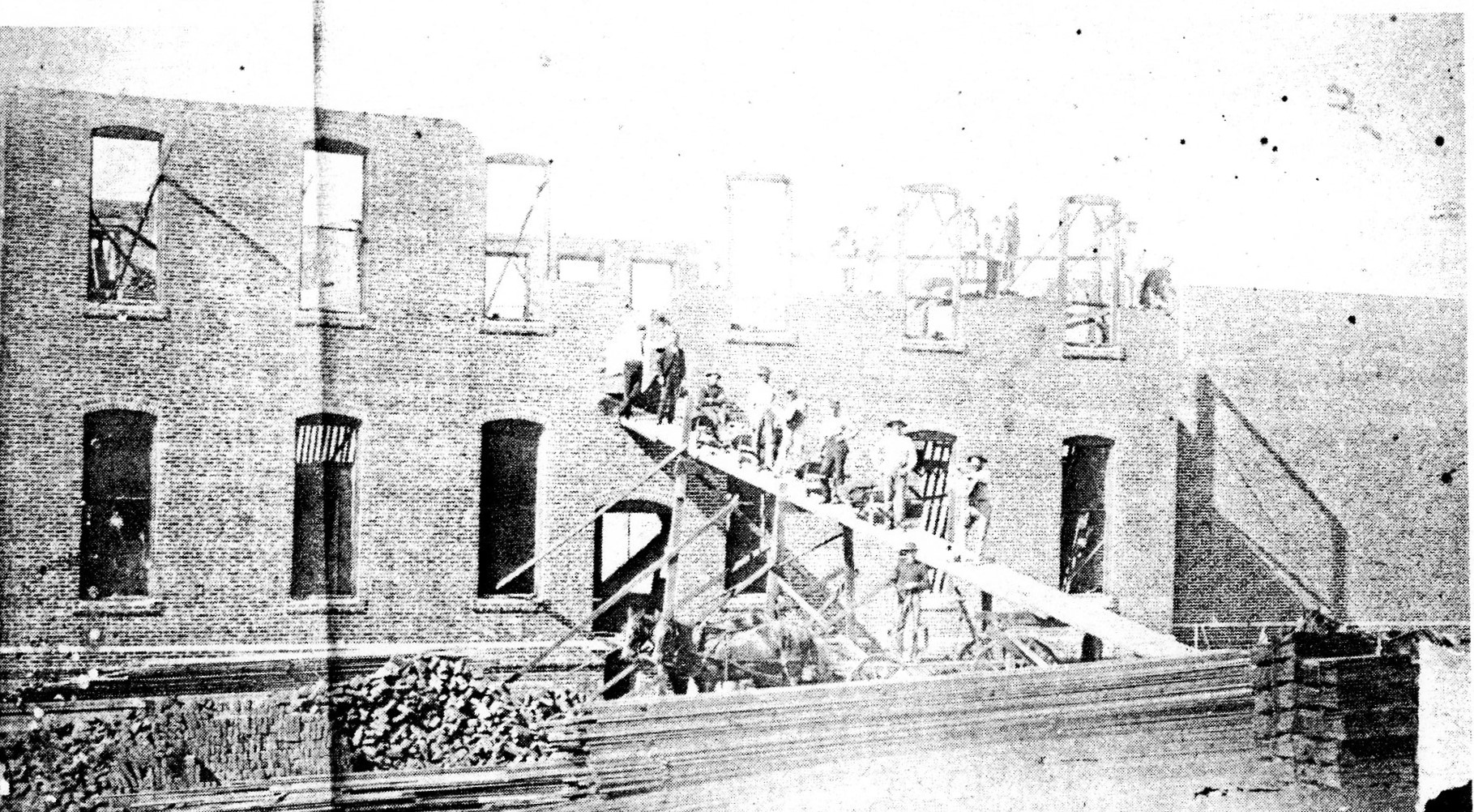
Chinese workers constructing the Stevenson Bros. Department Store at Kalmia Street and Grand Avenue in 1890, according to the CSUSM project’s Pioneer Room caption.Credit: Photographer not statedImage credit and rights
Credit
Photographer not stated, 1890. Courtesy of the Pioneer Room, Escondido Public Library, via the CSUSM Asian Immigrants in Escondido project; public domain in the United States.
The photograph is public domain in the United States based on its 1890 creation date; retain the source attribution and do not assign names or roles to individual workers beyond the source caption.
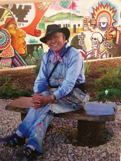
Muralist Salvador R. Torres at Chicano Park in 2022. Torres helped interpret student designs for Escondido’s 1990 historical mural; this photograph does not show that mural.Credit: DboxellImage credit and rights
Credit
Photo by Dboxell, CC BY-SA 4.0, via Wikimedia Commons.
Reuse under CC BY-SA 4.0 with attribution and share-alike terms; do not imply endorsement or confuse the background Chicano Park art with the restricted Escondido Historical Mural.
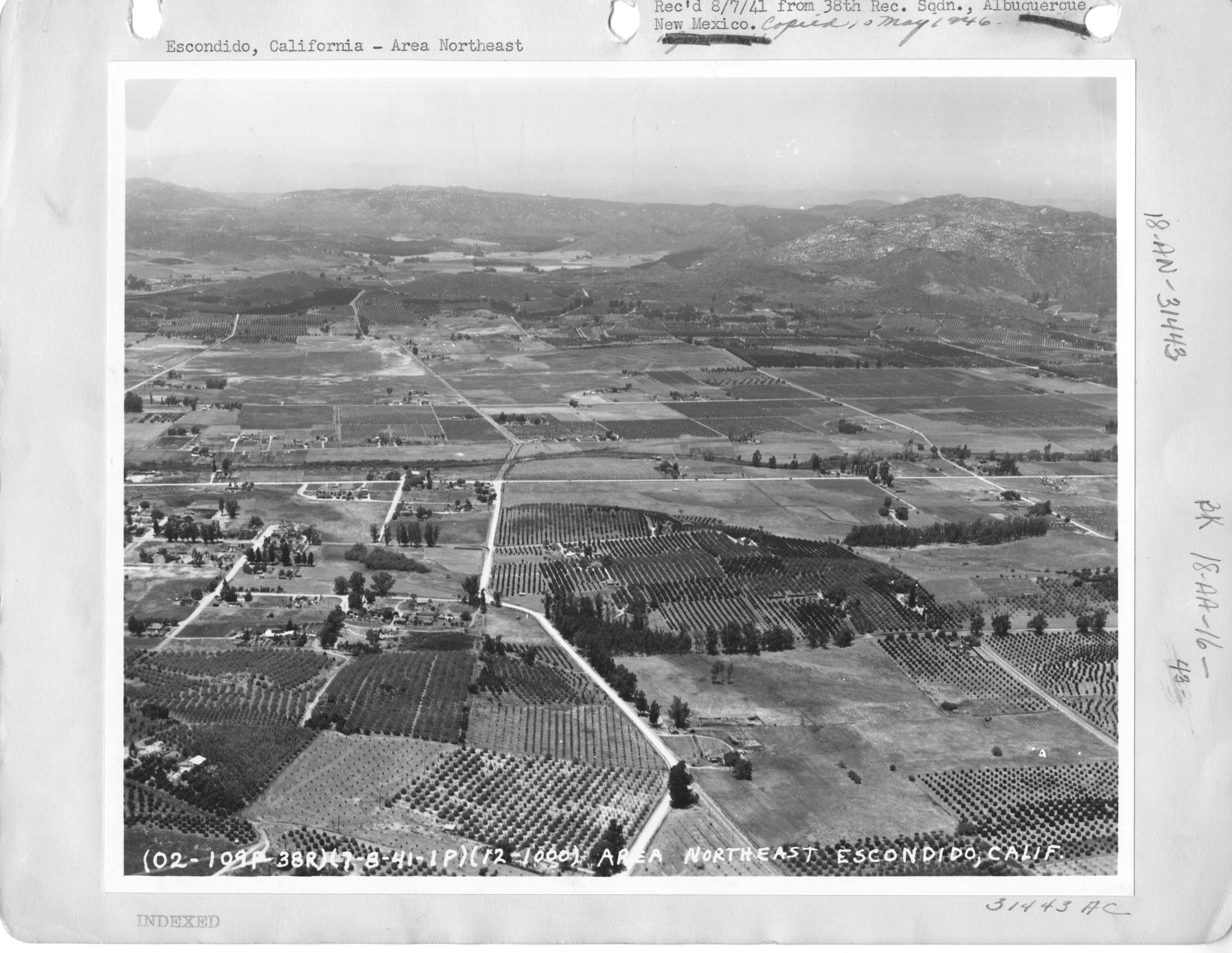
Aerial view northeast over Escondido’s orchards and farms, photographed July 9, 1941.Credit: Unknown photographer; U.S. military aerial reconnaissanceImage credit and rights
Credit
U.S. military aerial reconnaissance photograph, July 9, 1941; National Archives and Records Administration, NARA ID 23934313, via Wikimedia Commons.
Creator
Unknown photographer; U.S. military aerial reconnaissance
Public domain U.S. government work. The date is transcribed from the image border; do not infer property boundaries, ownership, or the identity of specific farms from the image alone.
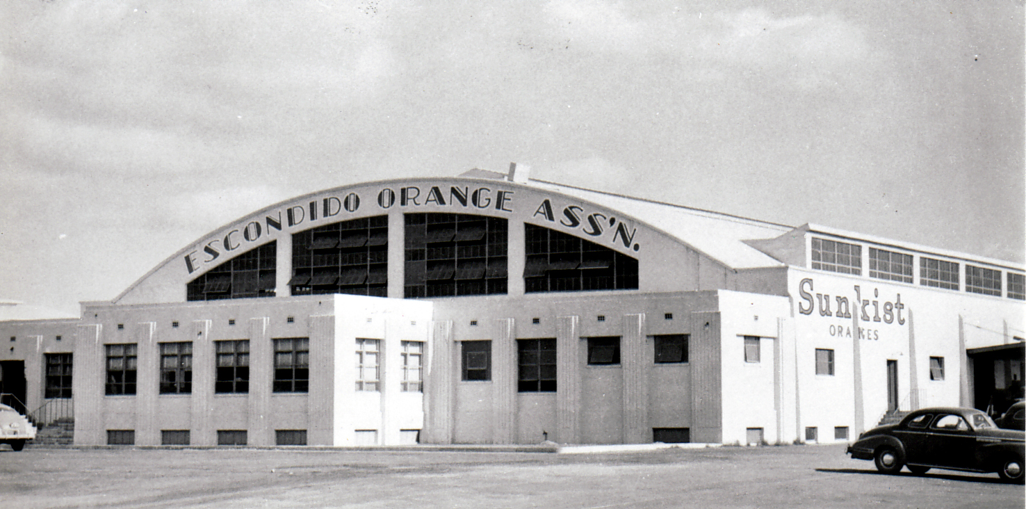
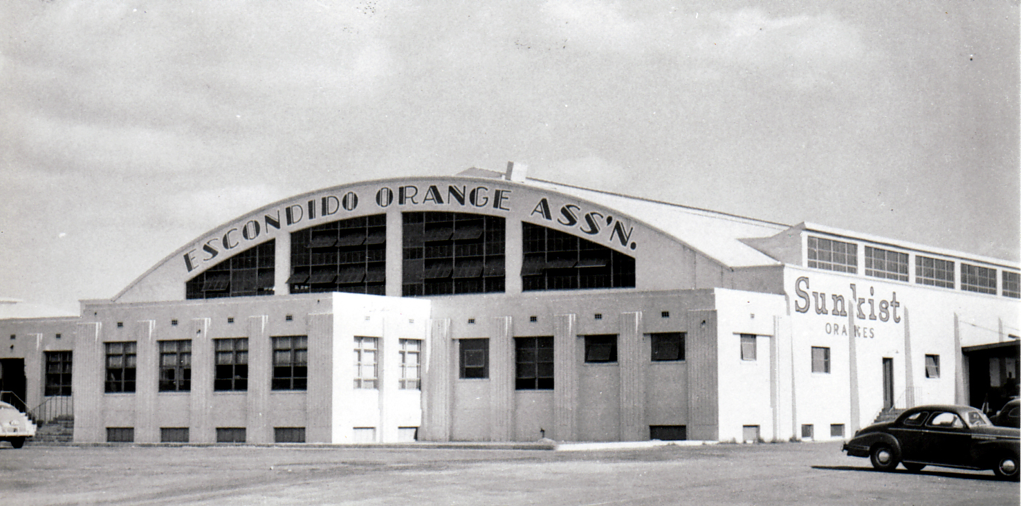
The Escondido Orange Association Sunkist packing-house building. The source page provides catalog #421 but no date.Credit: Photographer not identified on source pageImage credit and rights
Credit
Escondido History Center, catalog #421; photographer not identified on source page.
Displayed only on Escondidopedia’s History of Escondido page and timeline with source attribution and link-back; remove on a substantiated publisher or rights-holder request.
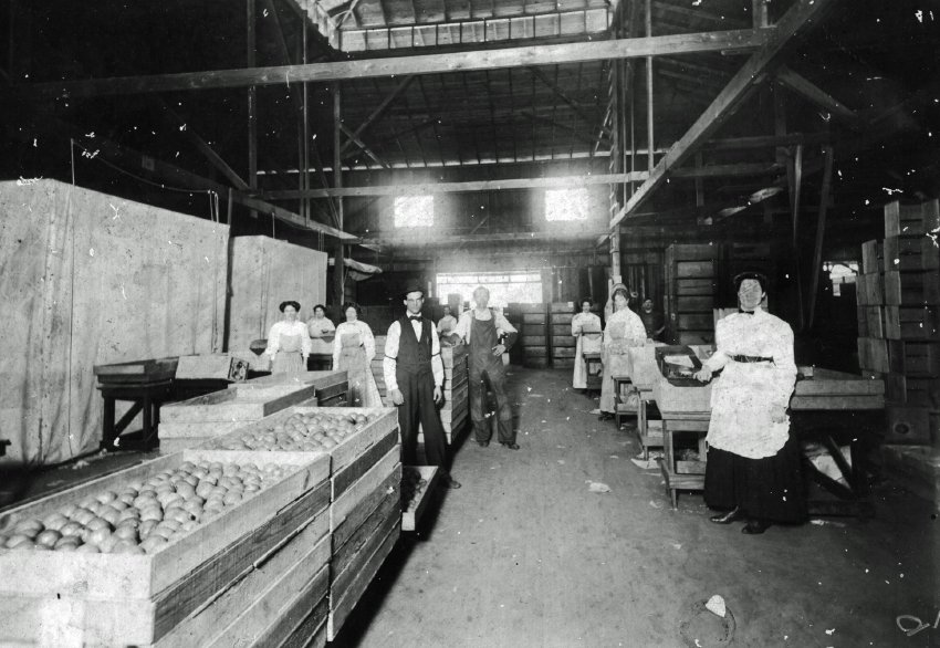
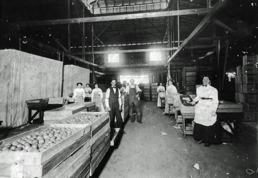
People working inside an Escondido produce-packing facility. The source page provides catalog #396 but does not identify the people or date.Credit: Photographer not identified on source pageImage credit and rights
Credit
Escondido History Center, catalog #396; photographer and people not identified on source page.
Displayed only on Escondidopedia’s History of Escondido page and timeline with source attribution and link-back; remove on a substantiated publisher or rights-holder request.
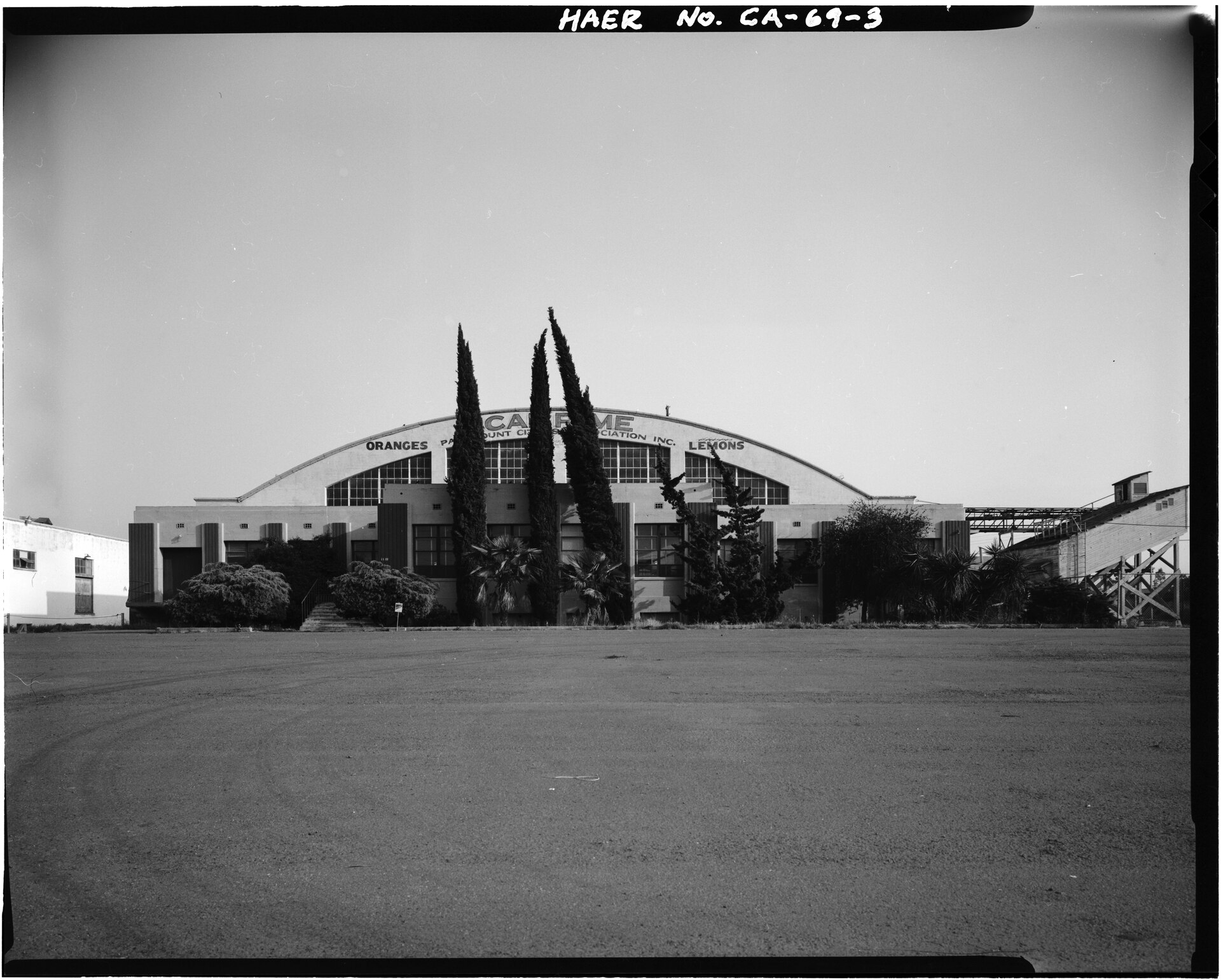
North front of the Escondido Orange Association Packing House in a 1989 HAER documentation photograph.Credit: H. J. KolvaImage credit and rights
Credit
H. J. Kolva, 1989. Historic American Engineering Record, Library of Congress, HAER CAL,37-ESCO,1-3.
Public domain U.S. government documentation. This photograph records the surviving building in 1989; do not present it as a view of active 1930s operations or the interior of the 1894 packing house.
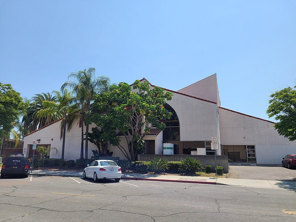
Escondido Public Library on Kalmia Street.Credit: Alan IslasImage credit and rights
Credit
Photo by Alan Islas, CC BY-SA 4.0, via Wikimedia Commons. Local copy uses Wikimedia's 960px resized file; no Escondidopedia edits.
Reuse under CC BY-SA 4.0 with attribution, license link, share-alike for adaptations, and change indication if modified.
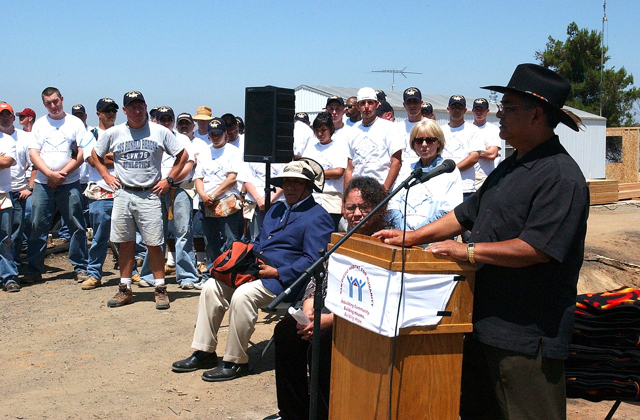
Then–San Pasqual Tribal Chairman Allen Lawson welcomes participants at a 2004 Habitat for Humanity event in San Diego. The public-role image shows Tribal leadership in community life; it does not depict every cultural practice named in this chapter.Credit: U.S. Navy photo by Deris JeannetteImage credit and rights
Credit
U.S. Navy photo by Deris Jeannette, 23 June 2004, via Wikimedia Commons; public domain in the United States. Local copy uses Wikimedia's 1280px resized file; no Escondidopedia edits.
Public-domain U.S. Navy work; retain the 2004 date and former-role wording, and do not imply current office, endorsement, or that the event is a cultural ceremony.
A Longer Starting Point
Escondido's history did not begin with a land company, a railroad, or incorporation. Archaeological evidence reviewed by the City reaches back about 10,000 years across the San Diego County region. That date describes the evidence in one archaeological synthesis, not the beginning of Native life. The same review describes distinct Kumeyaay and Luiseño communities, villages, food systems, and long exchange before 1769, while cautioning against drawing simple cultural boundaries from artifacts.
The official history of the San Pasqual Band adds a different and essential kind of source: the Band's own public account. It describes mission-era displacement and cultural continuity, the skilled community that established San Pasqual Pueblo, prosperity under Panto, the rejection of the Treaty of Santa Ysabel, and forced dispersal. The Band's current culture page makes clear that Kumeyaay history is living history.
That account should not be read as proof that the Escondido Valley belonged to Mission San Diego. The City review says the valley was outside the formal jurisdiction of both Mission San Diego and Mission San Luis Rey, while mission-associated parties still entered the area seeking Native laborers and religious converts. This distinction between mission boundaries and colonial reach is central to Chapter 3.
Work, Migration, And Community
The familiar story of Escondido's land company, railroad, Victorian and Craftsman homes, incorporation, Grape Day, and municipal government is one strand. Agriculture tied that civic growth to land, migration, and labor: rail service expanded exports, vineyards and citrus groves shaped the economy, and some citrus groves later shifted to avocados. Research built from Pioneer Room material also records Chinese immigrants making bricks, constructing buildings, and operating businesses; Japanese cooks working at Hotel Escondido; and Filipino residents picking and packing lemons while sustaining community traditions such as Rizal Day.
These examples are not a complete immigration history. They are specific, sourced starting points that make individual work and community life visible instead of reducing immigrants to population counts.
Two later chapters add documented Latino entry points. The Mexican American Art Since 1848 archive dates the Escondido Historical Mural to 1990 and credits 35 students and teachers, Salvador and Gloria Torres, and the Felicita Foundation in its community production. The City's current Pioneer Room page also says its Latinos in Escondido Oral History Project is actively expanding Latino collections. The project's public existence and invitation are documented here; unpublished interviews are not.
The interactive timeline now lives on the History & Culture page and presents nineteen equal-size chapters. Each image spans the chapter above its text so landscape photographs remain large and captions do not obscure them. Every chapter links to reviewed source records, and every image includes a description, context note, and rights information. The generated dated-record archive remains available below the curated story for readers who want the broader claim chronology.
Limits And Next Research
This edition is strongest on the San Pasqual Band's public history and on late nineteenth- and early twentieth-century Asian immigrant experiences documented by the Pioneer Room and CSUSM project. The 1990 mural and active Latino oral-history project add two specific Latino entry points, but they are not a substitute for a broad, community-authored account of Mexican and Mexican American family life, work, migration, organizing, and culture after 1848. Luiseño-authored history, Black residents, later migration, and other communities also need more depth. Those are named research gaps, not evidence that the histories were absent.
A requested search for Ting's Pharmacy remains an image-acquisition lead. No History Center photograph was assigned to the Chinese-immigrant chapter because the public gallery does not identify a pictured building or person closely enough to support that connection.
Evidence and maintenanceReferences, source dates, and review trail
References, saved source material, and review notes are kept here for readers who want to verify the page or help maintain it.
Good to know
Use this page as a sourced starting point for following a source-backed path through related local pages and records.
The San Pasqual Band pages are the authority for the Band's public account of its history and culture. The City cultural-resources report is used as a dated...
Change and source dates
Latest page update
Aug 22, 2026
Latest source check
Aug 16, 2026
Cited source date
May 24, 2026
A newer source should be checked before changing current status, access, roles, schedules, or practical details.
City of Escondido · web-page · retrieved Aug 16, 2026 · Origin
Source Notes
The San Pasqual Band history and culture pages are used for the Band's public account of Kumeyaay history and living culture. The City cultural-resources report is a dated archaeological and historical synthesis, not a Tribal voice; it supports the narrower finding that the valley was outside formal mission jurisdiction but encountered mission-associated parties. The CSUSM pages are archive-based student research highlighted by the Pioneer Room; individual statements remain attributed to that project. The Mexican American Art Since 1848 item supports an attributed account of the 1990 mural's community production; its copyrighted image is not reproduced. The current Pioneer Room page supports only the public existence, purpose, and invitation of its Latino oral-history project, not interview content. The City Grand Avenue page supports only the civic milestones it states. Selected History Center photographs are reproduced under the project's bounded owner-attributed historical-image policy. Each image record carries restricted rights status, visible attribution, a collection link, context limits, and removal terms; the policy does not claim that copyright is cleared.











_Sailors_watch_as_San_Pasqual_Tribal_Chairman_Allen_Lawson,_welcomes_guests_to_the_media_availability_for_a_Habitat_for_Humanities_project,_%5Eldq.jpg)
